 |
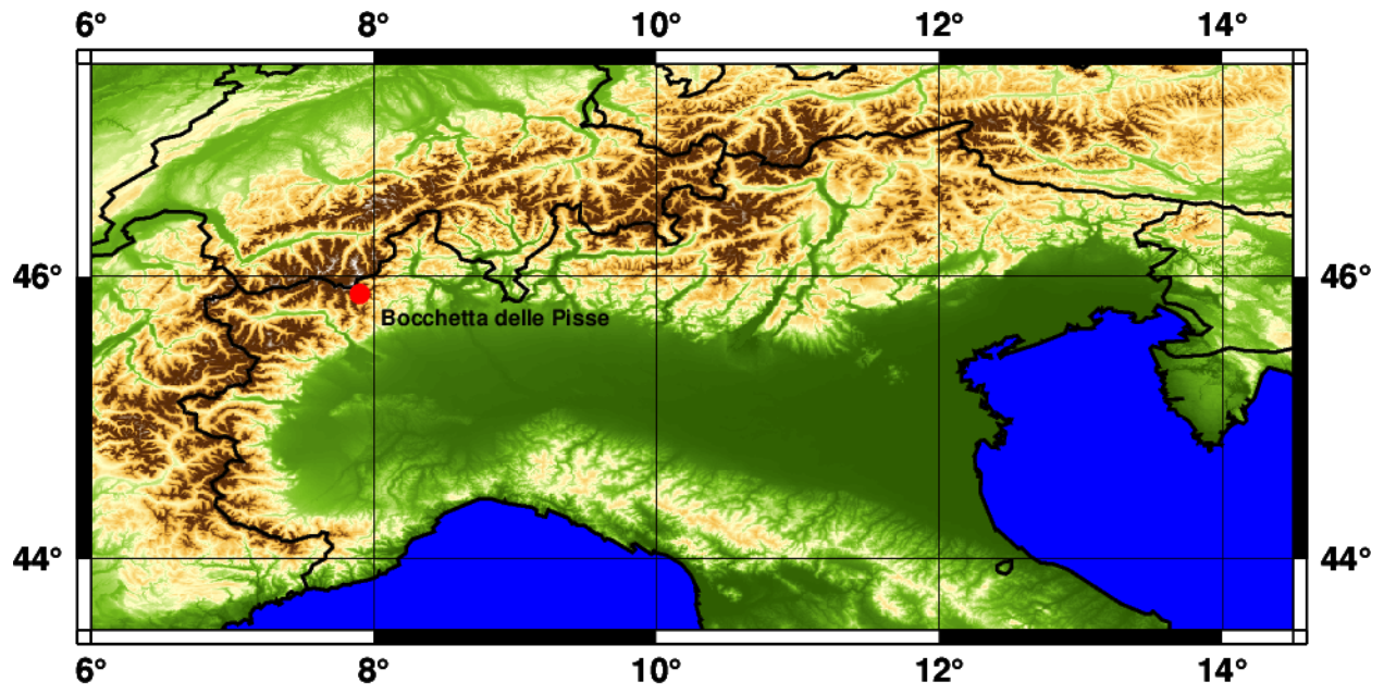
Seasonal snow depth forecasts November 2023 - May 2024Initialization November 1st, 2023, site of Bocchetta delle Pisse, NW Italian Alps |
|

|
Seasonal forecasts provide ensembles of the expected evolution of climate variables a few months ahead. We employ the seasonal forecasts of the main meteorological variables (air temperature, precipitation, shortwave and longwave radiation, relative humidity, wind speed, surface temperature) provided by the Copernicus Climate Data Store (C3S) and we use them to drive the physically-based snow model SNOWPACK (Bartelt and Lehning, 2002) in order to simulate snow dynamics at the local scale. In particular we estimate the temporal evolution of the snow depth at selected high-altitude locations in the Italian Alps. The figure below (Figure 1) shows the snow depth forecast for the current season, November 2023 - May 2024, at the station of Bocchetta delle Pisse, 2410 m a.s.l. in the Western Italian Alps, obtained using the seasonal forecast model ecmwfS51. |
Initialization year:
Elevation: 2410 m a.s.l.
|
Snow depth forecasts for the season 2023/2024 |
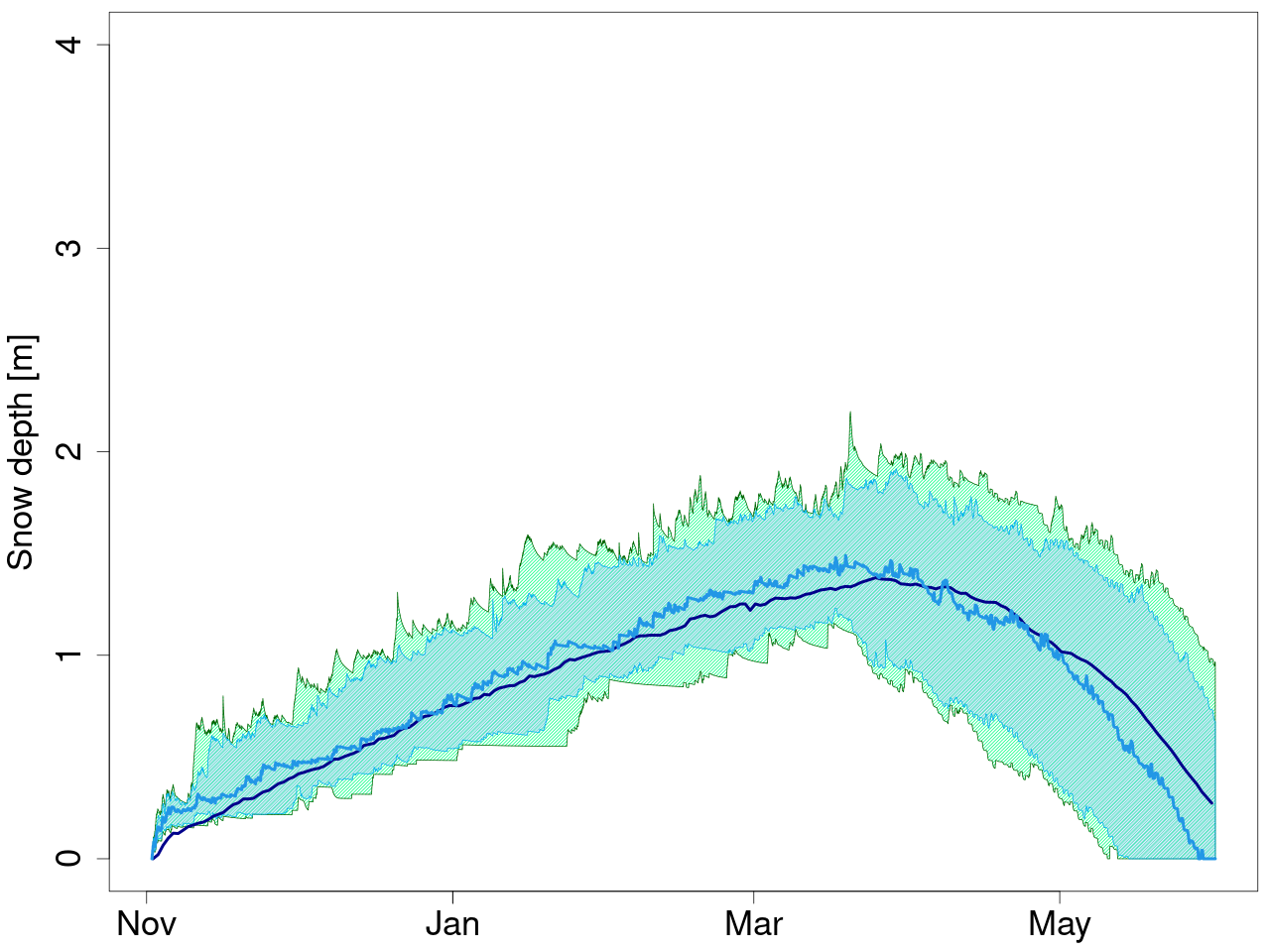 The ensemble median above/below the model median corresponds to a snow depth forecast above/below the average historical conditions for the period, respectively.
The forecast is skillful if the ratio between the ensemble median and the model median is similar to the ratio between the observed snow depth and the observed climatology.
The ensemble median above/below the model median corresponds to a snow depth forecast above/below the average historical conditions for the period, respectively.
The forecast is skillful if the ratio between the ensemble median and the model median is similar to the ratio between the observed snow depth and the observed climatology.
Figure 1: ecmwfS51-SNOWPACK snow depth ensemble forecast (25 ensemble members) initialized on November 1st, 2023 and issued for the 7 months ahead, up to May 31st, 2024.
|
Tercile-based forecasts |
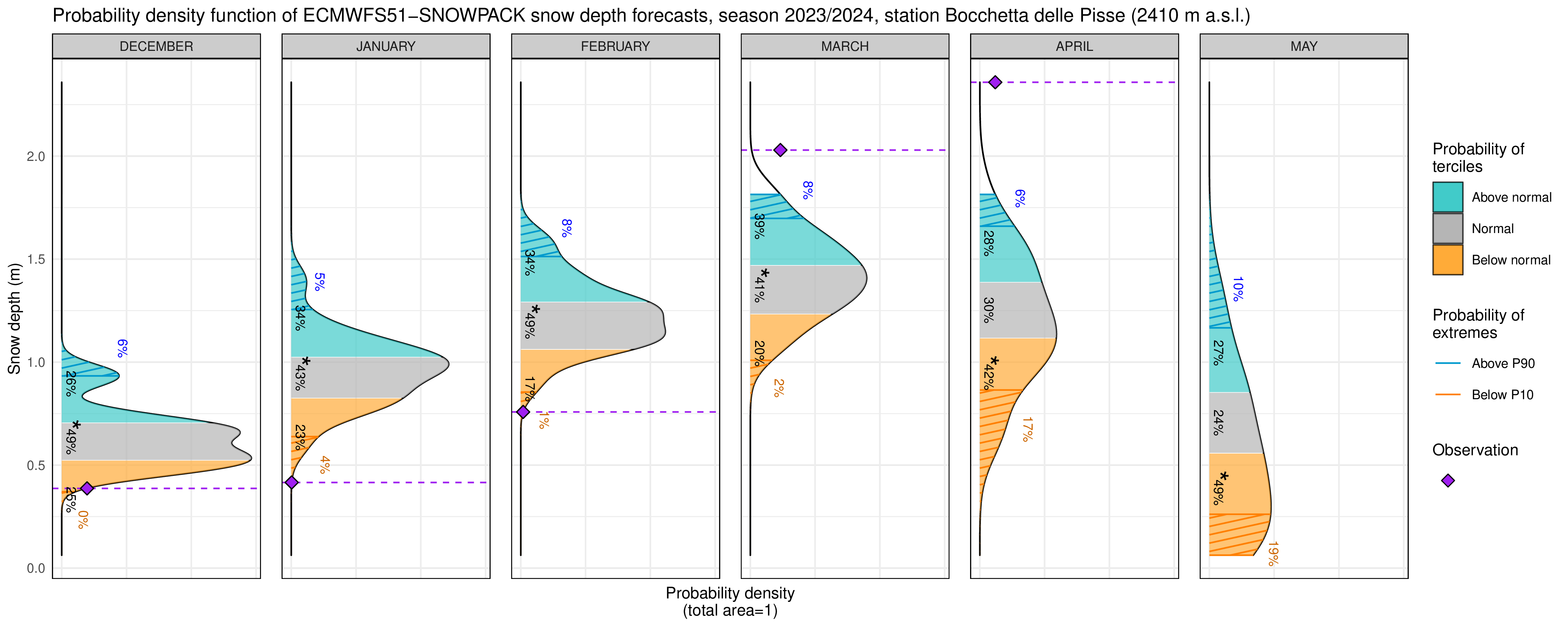 Highest probability (indicated by the asterisk “*” ) in the lower/middle/upper tercile means that we expect snow depth below/near/above the normal values for the period.
|
| Figure 2: Probability density function (PDF) of the ecmwfS51-SNOWPACK model monthly mean snow depth forecast for each month of the season. |
|
Areas in orange, grey and cyan color represent the probabilities to have monthly average snow depth below, near and above the normal conditions, respectively, and the asterisk indicates the most likely tercile. Areas with orange and cyan stippling represent the probability to have monthly snow depth below the 10th percentile and above the 90th percentile, respectively. |
References
|